Queensway Gold Project
Queensway Project Overview
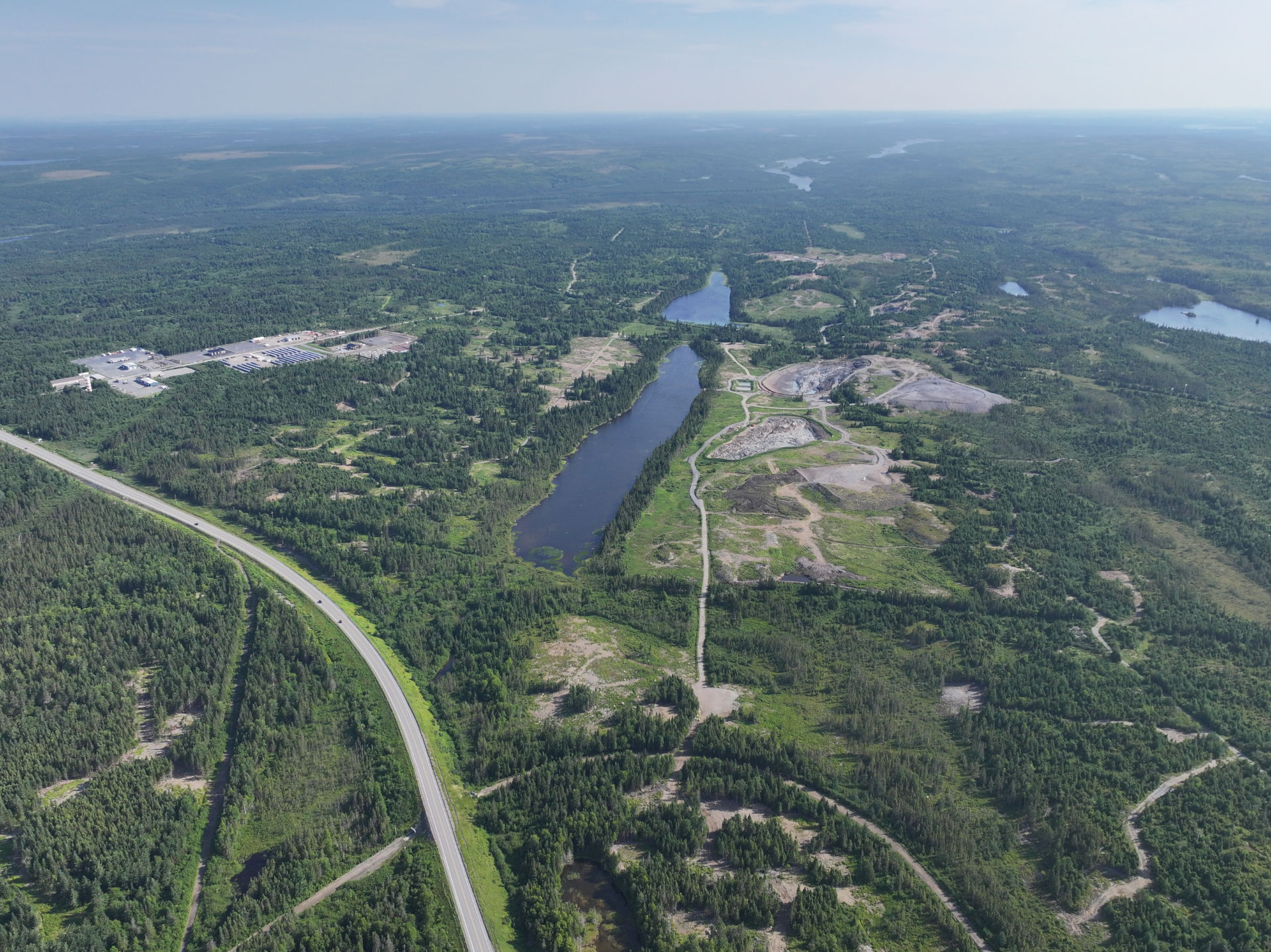
The Queensway Gold Project encompasses approximately 175,000 hectares, covering more than 110 km of strike on two primary fault zones: Appleton (AFZ) and Joe Batt’s Pond (JBP) that are spatially associated with the key gold discoveries made to date. Strategically located on the Trans-Canada Highway, 15 km west of Gander, the project is divided by Gander Lake into Queensway North and Queensway South.
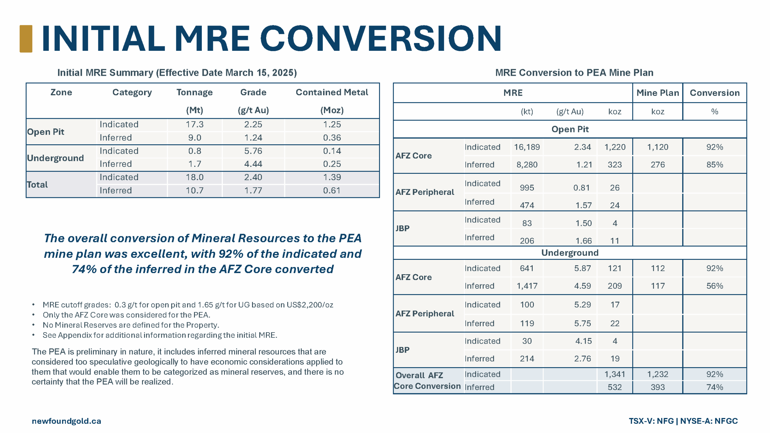
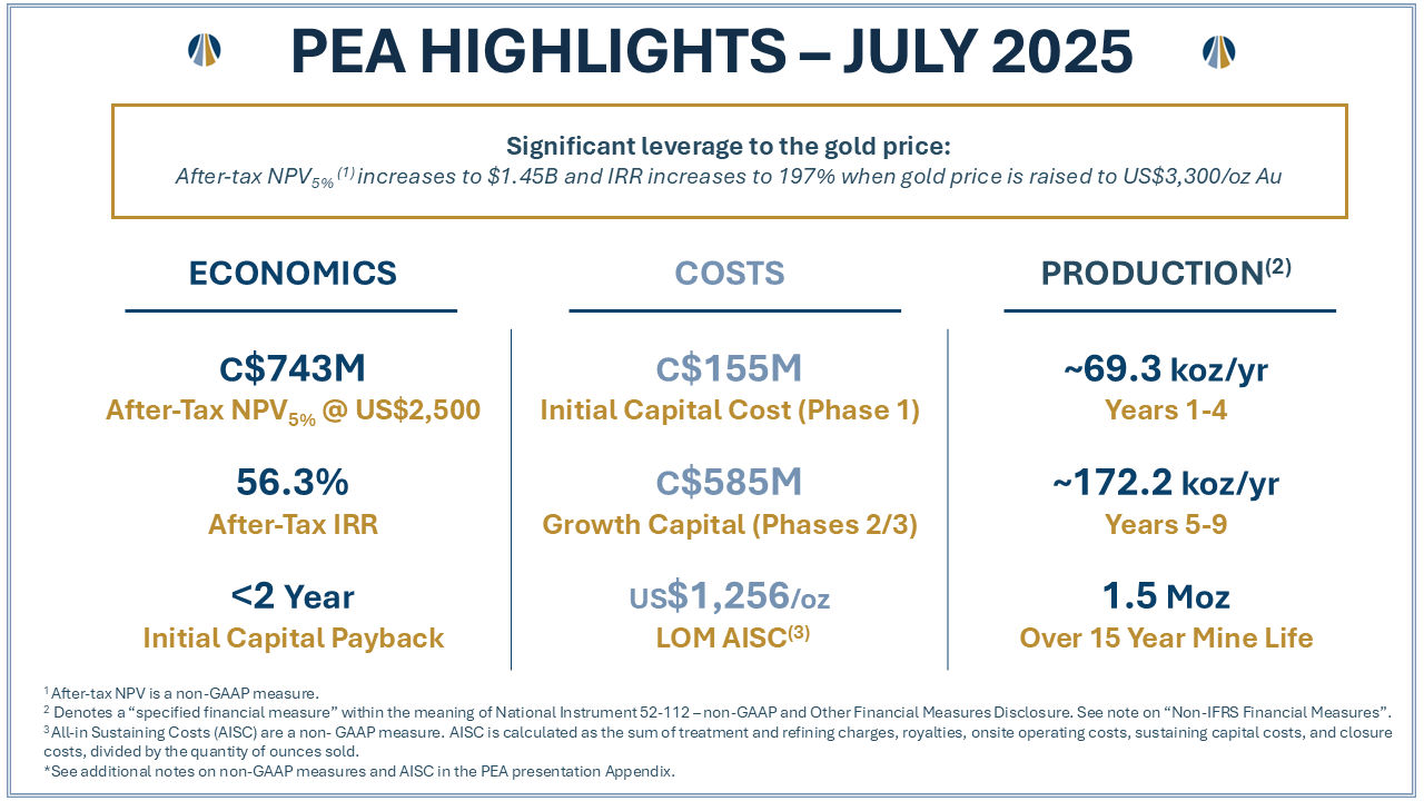
New Found has completed an initial Mineral Resource Estimate (MRE) on Queensway, and released a Preliminary Economic Assessment in July 2025, which demonstrates a solid low-cost profile via a phased mine plan.
Please refer to the New Found Gold disclaimer page for additional information pertaining to the PEA.
Ongoing environmental baseline studies include surface water and sediment sampling, vegetation, wetlands, bird, wildlife, and aquatic assessments. Additionally, hydrogeological and geotechnical investigation studies have been initiated, including geochemical characterization of the host rock.
Technical Reports
Access our current NI 43-101 Technical Report on the Queensway Gold Project.
Qualified Person
The scientific and technical information disclosed on this website was reviewed and approved by Melissa Render, P. Geo., President, and a Qualified Person as defined under National Instrument 43-101. Ms. Render consents to the publication of the information on this website, by New Found Gold. Ms. Render certifies that this website fairly and accurately represents the scientific and technical information that forms the basis for this website1.
- Please refer to the New Found Gold disclaimer page.
Queensway North
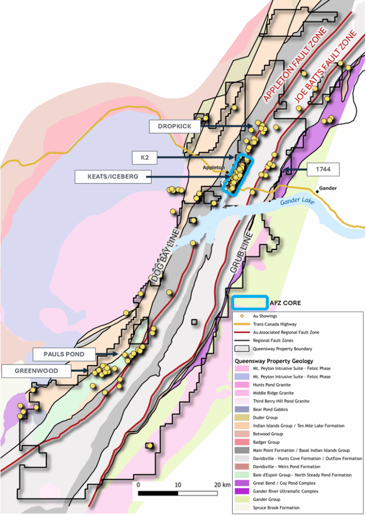
Focused on a 22 km+ corridor along the AFZ, Queensway North includes multiple high-grade gold zones, including Keats Main, Iceberg, Keats West, K2 and Lotto forming the AFZ Core, which hosts the majority of the gold ounces discovered to date. These near-surface high-grade discoveries have largely been explored at vertical depths less than 250 metres, leaving the potential to expand at depth. Drilling has identified targets more than 11 kilometres from the AFZ Core including the Dropkick zone, and expanded on mineralization at AFZ Peripheral, showcasing the continued discovery potential at Queensway North. Ongoing drilling aims to expand these discoveries and identify new targets via the 2025 work program.
New Found has completed an initial Mineral Resource Estimate (MRE) on Queensway, and released a Preliminary Economic Assessment in July 2025, which demonstrates a solid low-cost profile via a phased mine plan. Learn more: PEA Results Presentation.
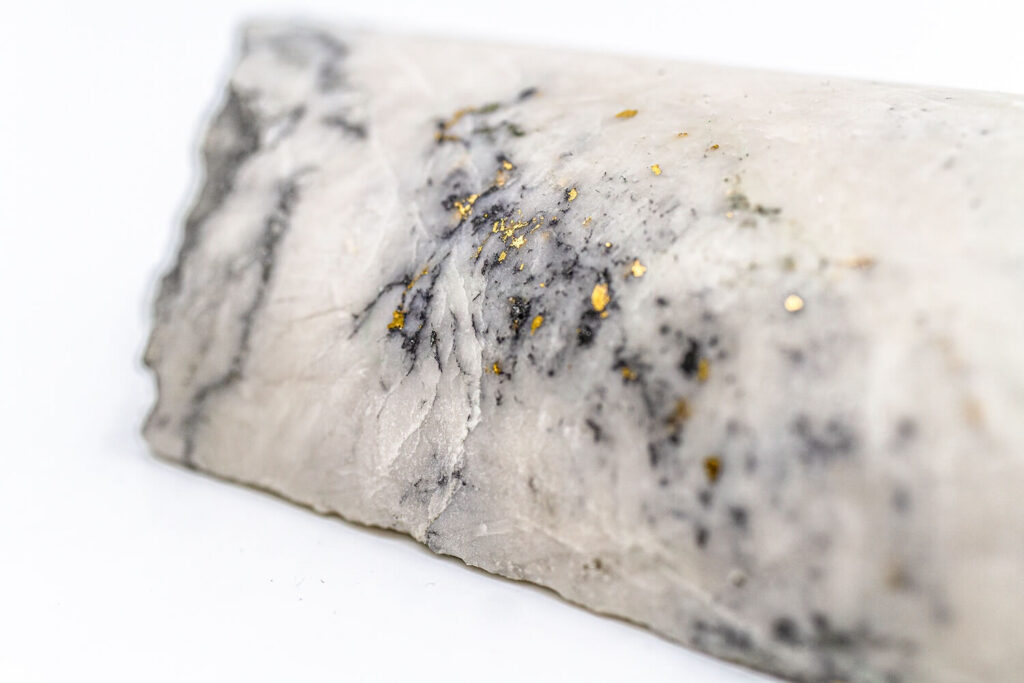
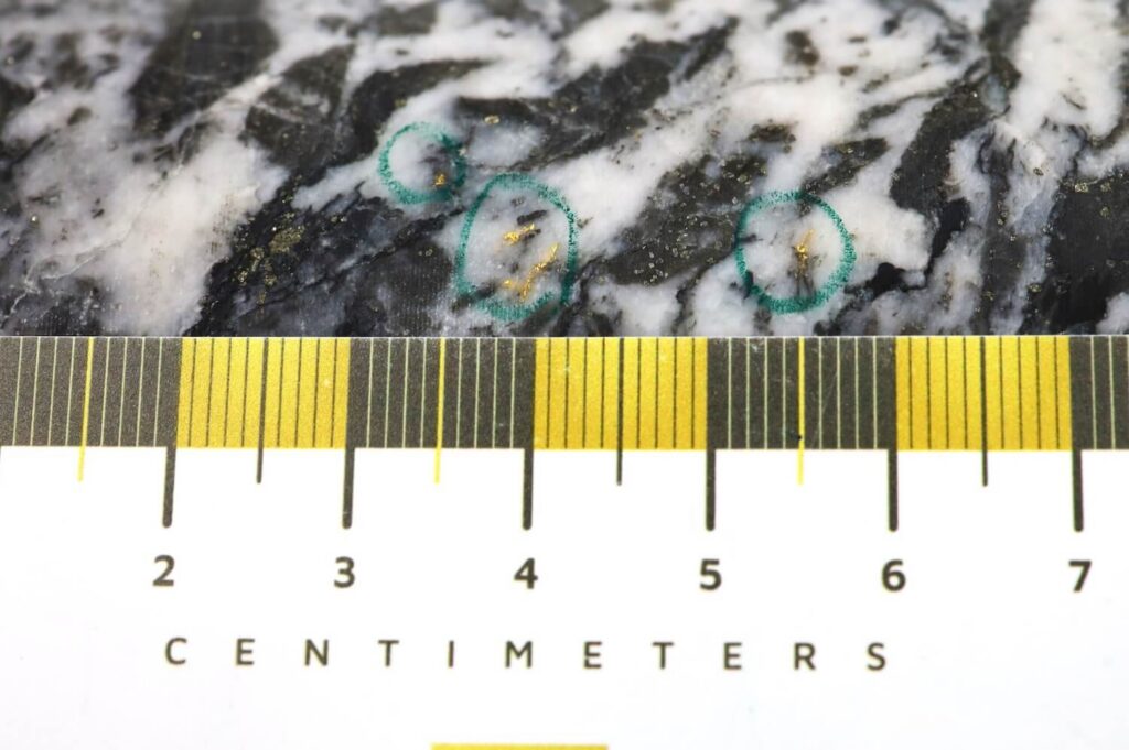
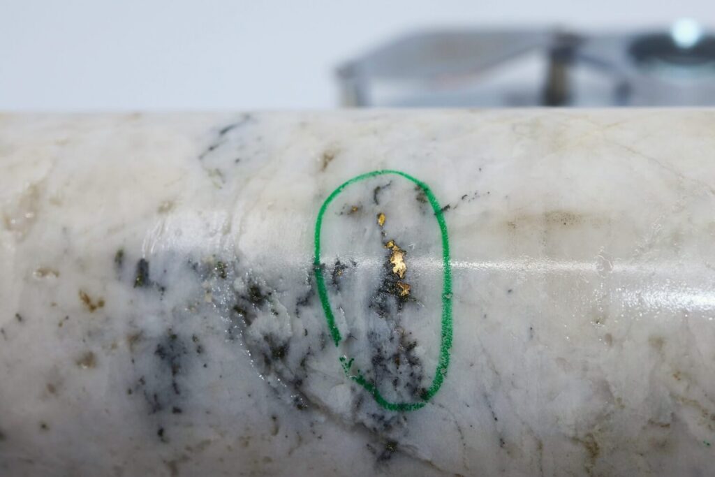
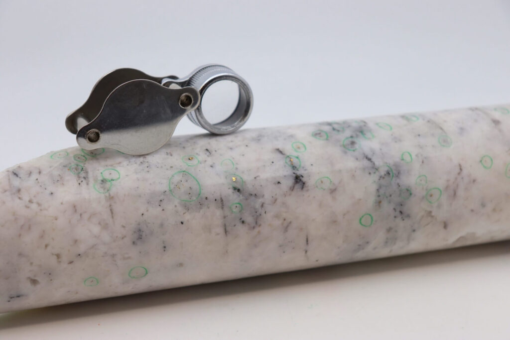
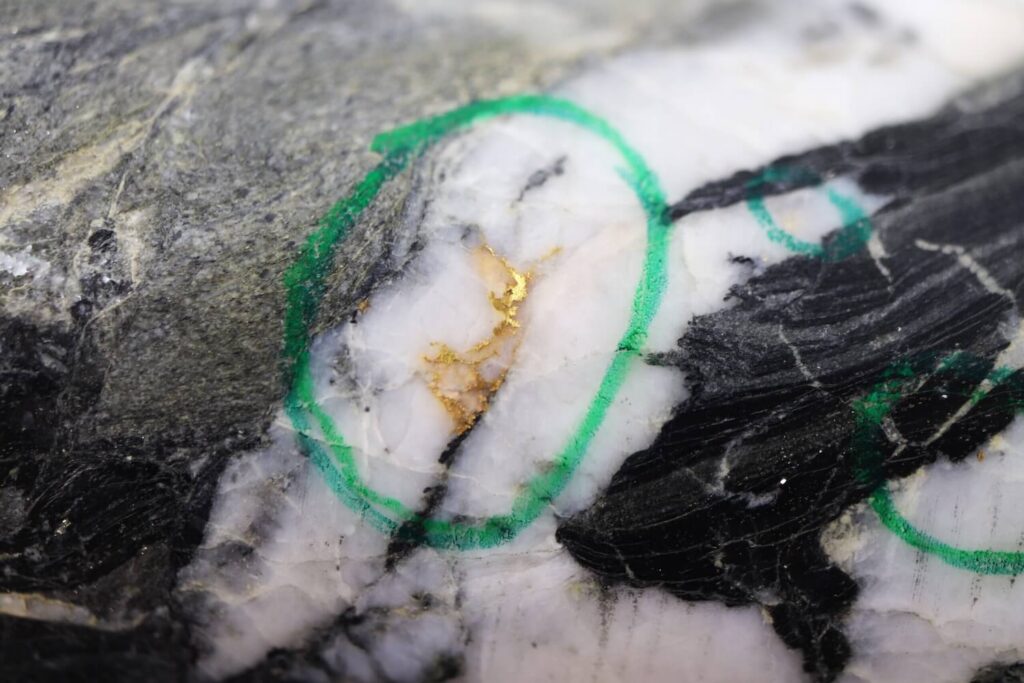
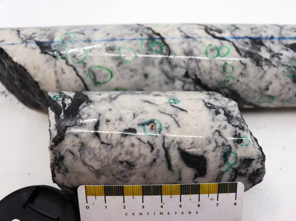
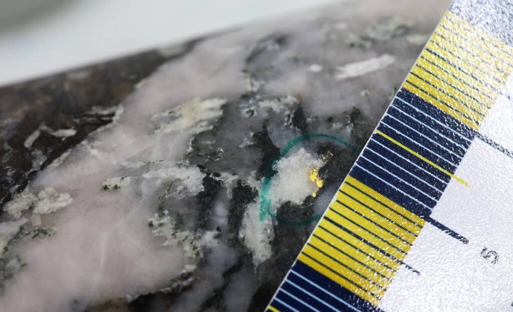
Cautionary note: Pictures of selected core with free gold are not intended to be representative of gold mineralization throughout the deposit.
Queensway South
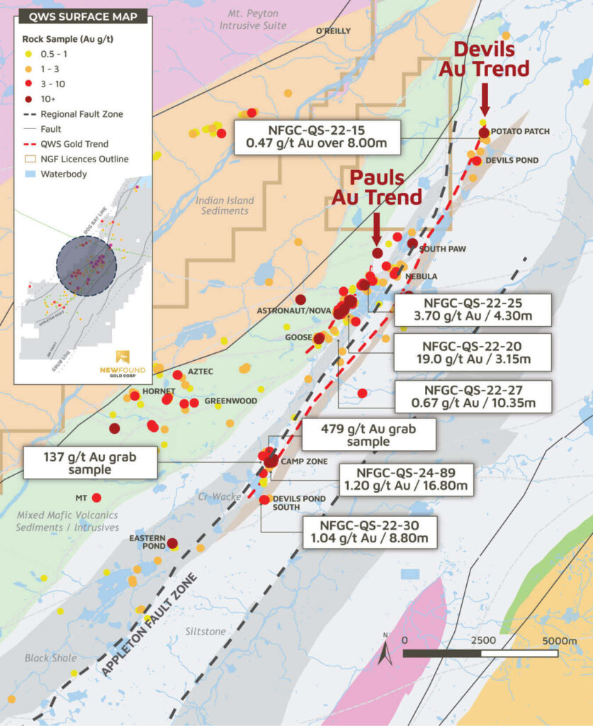
Queensway South is the 80 km southern extension of the highly prospective AFZ and JBP fault structures explored at Queensway North. In early 2025, New Found Gold began a regional exploration program at Queensway South and Queensway North, following up on high-priority targets generated by earlier regional programs. This work will include soil and rock sampling, trenching, a 156 square kilometre magnetic survey and a quaternary geological study.
- 3,425 m drilled in 19 holes completed
- ‘Potato Patch’ discovery, expansion of Devils trend
- VG found in five holes over at the Bernards Pond target
- 8,300m drilled in 37 holes completed
- 1,200 rock samples collected
- 9,900 soil samples collected
- ‘Camp Zone’ Discovery, expansion of Pauls Pond trend
- VG in 22 holes over 4 targets including ‘Camp Zone’
- Inaugural drill program: 7,255 m drilled in 33 holes at 8 targets
- 27 out of 33 holes hit significant Au mineralization
- VG in 10 holes over 4 target areas
- 2.5km long Au trend at Pauls Pond
Queensway South – The Makings of a District


Cautionary note: Pictures of selected core with free gold are not intended to be representative of gold mineralization throughout the deposit.
Regional Geology
The Queensway Gold Project is situated within the Central Newfoundland Gold Belt, characterized by favorable geology and structures conducive to gold mineralization. The Property is located along a continental collision margin formed as part of the Appalachian Orogeny – the collision of Laurentia with Gondwana and its micro-continents (Ganderia and Avalonia). The Dog Bay Line (DBL) is a major Silurian suture formed by the closing of the Tetagouche-Exploits back-arc basin and can be found on both sides of the Atlantic Ocean. The collision of two continental plates causes progressive compression, folding, faulting, and mineralization of sediments. This creates an ideal host for high-grade gold mineralization among spaces left behind during faulting. Epizonal gold systems form in the upper parts of orogenic deposition environments, where large amounts of gold can be deposited into relatively small areas during explosive events.
Visible gold is common as disseminations in quartz-carbonate veining. Accessory minerals include pyrite, arsenopyrite, chalcopyrite, sphalerite, stibnite and boulangerite.
Deposits at Queensway are primarily hosted in the Davidsville Sedimentary Group, a middle Ordovician turbidite sequence. This shallow marine siliciclastic sedimentary sequence consists of shales, siltstones, sandstones, and wackes. The metamorphic grade of these sediments is classified as sub-greenschist to greenschist facies. The Davidsville group unconformably overlies the Gander River Complex (ophiolites) in the east and conformably underlies the Indian Island Group in the west (shallow marine shale and limestone). Multiple geophysical surveys indicate that the primary host structures continue for over 110 km of strike within this host stratigraphy.
While no two mineral systems are ever identical, there is strong evidence to suggest the Central Newfoundland Gold Belt has many similarities to the Victoria goldfields. High-grade gold mineralization at Queensway focusses on small displacement accommodation faults, interpreted to be a similar process that focused the more recently discovered high-grade gold at the Fosterville Mine, initially at the Swan Zone. (Modified from Willman 2007). Bendigo goldfields has produced over 22 million oz of gold over its >150-year mining history. Fosterville Mine (Kirkland Lake Gold) is currently in production as one of the world’s highest grade and lowest cost gold mines.
Geologic Setting
Dog Bay Line
The Dog Bay Line (DBL) is a significant suture formed at the closing of the Iapetus Ocean and can be found on both sides of the Atlantic Ocean.
100+ km of strike
New Found identified this structure for its significant gold potential and consolidated land holdings over 110km of strike.
Prospecting in late 1980’s
Prospecting did not begin in the Queensway area until the late 1980’s when the first gold showing was recorded.
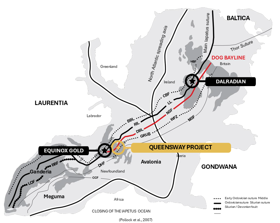
A number of large gold systems have been found along this suture zone including:
Curraginalt Deposit
Ireland

Valentine Lake Deposit
Newfoundland
Haile Deposit
North Carolina
Structural Setting
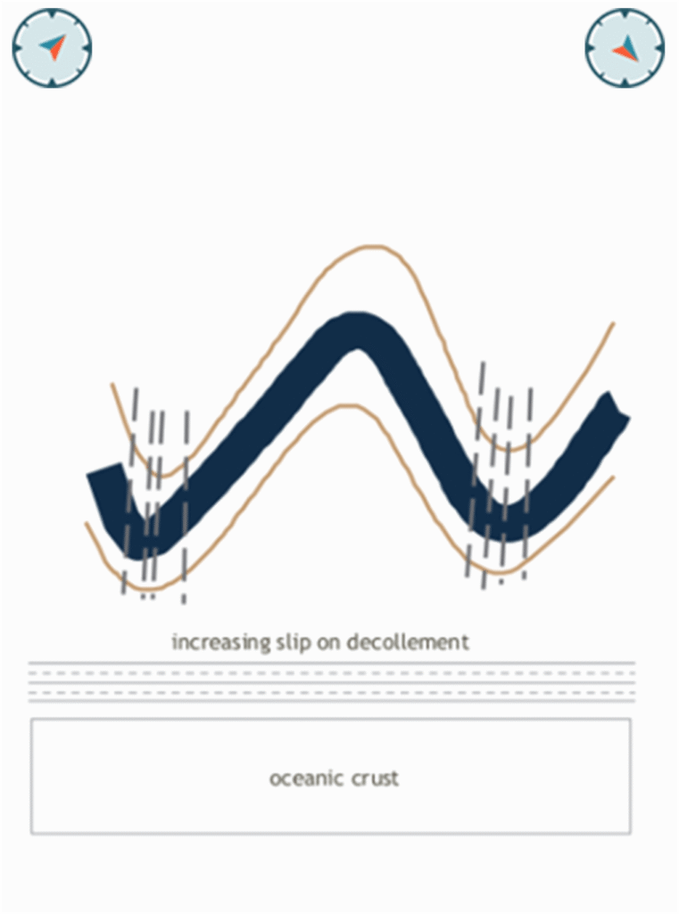
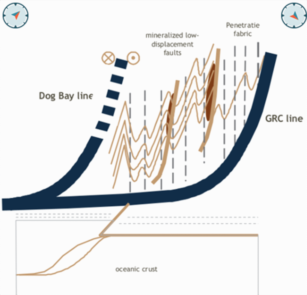
Progressive compression, folding, faulting and mineralization of sediments.
High-grade gold mineralization at Queensway focusses on small displacement accommodation faults, interpreted to be a similar process that focused the more recently discovered high-grade gold at the Fosterville Mine, initially at the Swan Zone. (Modified from Willman 2007)
Geology and Mineralization
Geology
Gold mineralization hosted in middle Ordovician sediments, of sub-greenschist to greenschist metamorphic grade.
Mineralization
Gold mineralization is fault hosted; visible gold is common as disseminations in quartz-carbonate veining.
Accessory Minerals
Accessory minerals include pyrite, arsenopyrite, chalcopyrite, sphalerite, stibnite and boulangerite.